The Rwenzori Mountains
For trekkers looking for mountainous treks close to the
equator, the Rwenzori Mountains are a huge pull. Better known to many as ‘the
Mountains of the Moon’, the Rwenzori Mountains in Uganda boast six of the
highest mountains in Africa. And while the Rwenzori Mountains see fewer
tourists than Mount Kilimanjaro in the neighbouring country of Tanzania,
they offer a hidden paradise for trekkers seeking adventures away from the
crowds.
Despite offering so much in terms of trails and
biodiversity, the Rwenzori remains a trekker’s paradise off the tourist beat.
As adventure travel experts, we at Kandoo specialise in creating adventures to
some of the world’s most iconic destinations, including Uganda, helping
you adventure beyond the ordinary and expanding your normal limits. The result
is a life-changing and unforgettable adventure.
In this blog, we’ll answer some of the most frequently asked
questions about travelling to the Rwenzori Mountains. For more information
regarding our trips to Uganda, get in touch with our friendly team at Kandoo HQ
who will be happy to answer any of your questions. For more detailed information about mountains in Uganda, head over to our blog on the mountains of Uganda and for more general information check out our ultimate guide to Uganda.
Where are the Rwenzori Mountains?
The nearest built-up area to the Rwenzori Mountains is the
city of Kasese. Kasese borders the districts of Kabarole and Bundibugyo in the
north, Lake George and Kamwenge in the east, Bushenyi and Lake Edward in the
south and the Democratic Republic of Congo in the west. It is easily accessible
by air from Entebbe International Airport (EBB), where your adventure will
begin and end when visiting Uganda, with daily flights taking just over an
hour. The flights depart Entebbe at 7am and 12:30pm daily, and line up well
with trek departures. Return flights leave Kaese at 10:45pm and 2:45pm daily.
It’s also possible to reach the Rwenzori Mountains location
by public bus from Kampala, the capital and largest city of Uganda, via Fort
Portal which takes 6-8 hours. The bus departs from Kamapala city centre every
hour and costs approximately 50,000 Ugandan Shillings (UGX), which converts to
around £11 (GBP) or $14 (USD).
However, whilst you can fly to Kasese or take public
transport, the best way to travel in Uganda is by private taxi. It’s relatively
inexpensive but much safer. We would recommend organising a private transfer to
the Rwenzori Mountains National Park which would not cost much more but be much
mor efficient than bus of flying.
When you book a trip with Kandoo Adventures, all transfers
are arranged for you.
Facts about the Rwenzori Mountains
- The Rwenzori Mountains of Uganda are the largest
mountain range in Africa, comprised of 6 major peaks and ranging somewhere
around 120km in length.
- The “Mountains of the Moon” is an ancient term
used to describe the Rwenzori Mountains since it was believed that the streams
from the Rwenzori Mountains made up one of the sources of the River Nile, due
to their snow-capped peaks which shimmer like the moon.
- More than 5 million individuals in the Rwenzori
region rely on the Rwenzori Mountains as a mountainous water source for their
domestic water needs.
- All the mountains in this area are named after
related explorers that came to Africa in the early years of colonialism.
- The Uganda Rwenzori Mountains National Park was
gazetted as a park in 1991 and as a UNESCO World Heritage Site in 1994.
- The park is home to over 70 mammal species, 217
bird species, 9 species of reptile and 6 species of amphibian.
Geography and climate of the Rwenzori Mountains
As Uganda lies on the equator, the seasons experienced here are
different to those in the Northern and Southern Hemispheres. The major defining
climatic factor in Uganda is rainfall and thus the two seasons – wet and dry
season. Uganda’s climate is largely tropical with two rainy seasons per year,
March to May and September to December although global warming is making the
arrival of these seasons more fluid. The northern region, which forms one
quarter of the country lies outside the tropical belt, and hence experiences
only one rainy season, March to October. The rest of Uganda lies within a
relatively humid equatorial climate zone and the topography, prevailing winds,
lakes and rivers cause large differences in rainfall patterns across the
country. The period from late June to early September and again late December
to the end of February does tend to have lower rainfall. These dry season
months are usually preferred for travellers since there is less chance of wet
weather, though it can rain at any time of the year.
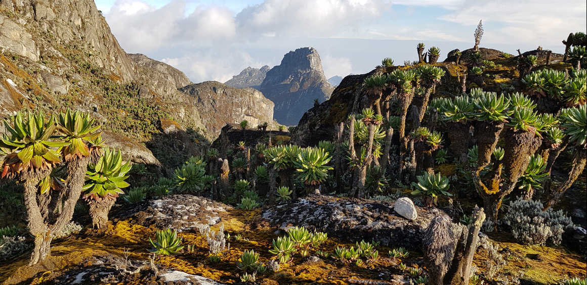
A trek in the Rwenzori Mountains in Uganda will take you
through a number of different altitudinal zones of vegetation, each with its
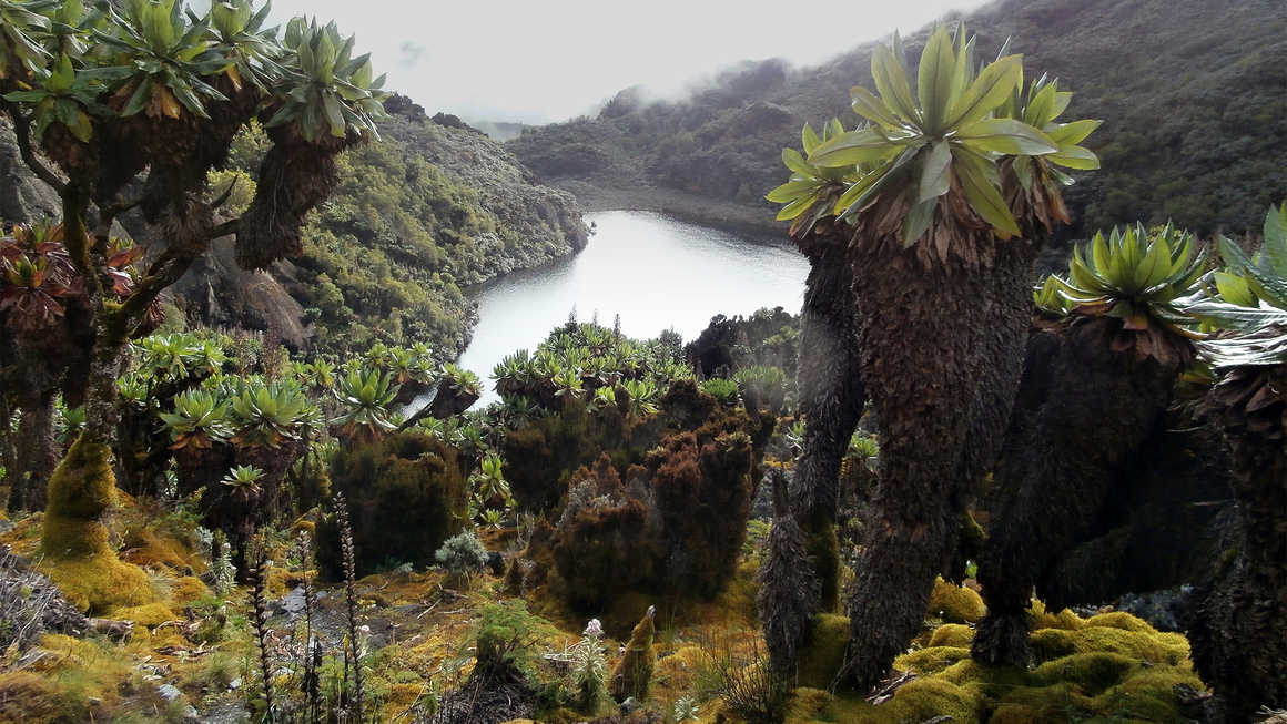
own micro-climate, flora and fauna. The varying climate zones of the Rwenzori
Mountains support distinct vegetation types, from lush rainforests to alpine
meadows and glacial environments in the higher elevations, contributing to the
Rwenzori’s rich biodiversity. There are 5 major vegetation belts in the
Rwenzori Mountains:
1.
Vegetation zone: 1,765m – 2,600m
2.
Bamboo zone: 2,600m – 3,000m
3.
Heather zone: 3,000m – 3,800m
4.
Moorland zone: 3,800m – 4,500m
5.
Rocky glacier: 4,500m+
Temperatures in the vegetation zone and bamboo zone
typically range from 15°C to 20°C (59°F to 68°F). At altitudes around the 3,000
to 4,000m mark, expect temperatures of 10°C to 15°C (50°F
to 59°F) during the day and 2°C to 6°C (35.6°F to 42.8°F) at night. Above
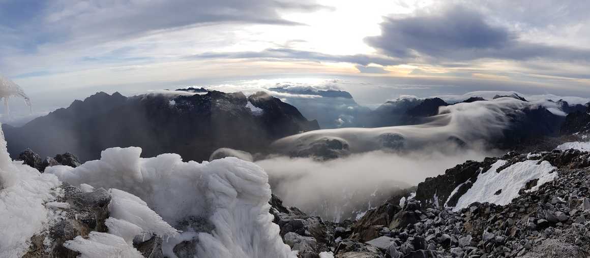
4,000m, temperatures can plummet below freezing, ranging from -5°C to 5°C (23°F
to 41°F). High winds are common on the peaks in the Rwenzori which also brings
a chill factor in poor weather. The Rwenzori are also renowned for having high
levels of rainfall. Even during the dry seasons expect some days to be misty or
damp. The best way to prepare for these temperature changes and weather
conditions is to bring lots of layers and a good quality waterproof jacket.
For our equipment recommendations for trekking in Uganda,
head over to our Uganda kit list.
Wildlife of the Rwenzori Mountains
The area is also home to around 200 bird species, including
numerous endangered species. Rwenzori Baris, Rwenzori turacos, blue sunbirds,
Archer’s robin chat, mountain buzzards, crimson wings, slender build starling,
barred long tailed cuckoo, handsome francolins, golden winged sunbird, montane
sooty boubou, black and swift eagles are all common.
People and culture of the Rwenzori Mountains
Like mountain people all around the world, the Bakonzo
people are industrious and self-reliant. The Rwenzori Mountains are a central
part of life of the Bakonzo people. In the local language (Lukonzo),
Rwenzori means Rainmaker, and they are called the ‘Mountains of The Moon’ as
during the day they are covered by cloud but are often clear at night and
visible by moonlight. The mountains provide an important source of water as
they supply water to the surrounding communities. Coffee has been the main crop
in the foothills, but more recently some people grow cocoa and cotton. Their
houses are made of a doubled layer of plaited bamboo, which is filled with clay
and traditionally roofed with grass or banana thatch though more frequently
with corrugated iron roof.
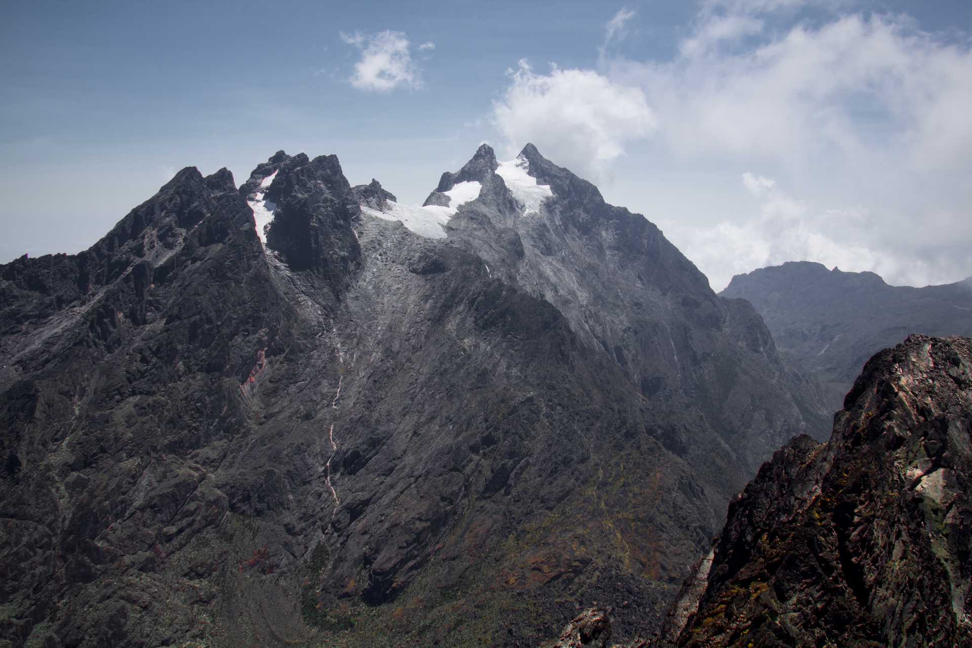
Highest peaks of the Rwenzori Mountains
Mount Stanley (5,109m)
Mount Speke (4,890m)
Mount Baker (4,844m)
Mount Emin (4,791m)
Mount Gessi (4,715m)
Mount Luigi de Savoia (4,627m)
Trekking in the Rwenzori Mountains
One of the benefits of trekking in the Rwenzori Mountains is
that the routes are typically longer than many other high-altitude treks such
as Mount Kilimanjaro, meaning you have longer to acclimatise and the risk of
altitude sickness is reduced. Altitude sickness, also called Acute Mountain
Sickness (AMS), is an illness caused by exposure to low air pressure,
especially low partial pressure of oxygen, which many trekkers experience at
high altitudes. It is most common at altitudes above 2,400 metres. For more
information, head over to our guide on how to avoid altitude sickness in
Uganda.
The Rwenzori Mountains National Park has three main trekking
routes, the Rwenzori Central Circuit, the Bukurungu Trail and the Kilembe Trail.
Starting from Mihunga gate, the Rwenzori Central Circuit is approximately 24
kilometres to Margherita peak and will take you around 7 days to complete. The
Kilembe Trail is longer than the Central Circuit and will take 8 days to
complete. With mountain huts for accomodation, this is the most comfortable of
the Rwenzori Mountain routes. From Kasanzi park gate in Omukorukumi village,
the Bukurungu Trail takes 8 days to reach the peak.
At Kandoo Adventures we run trips to Mount Stanley, the Rwenzori Mountains highest peak, along the Kilembe Trail every month during
the dry seasons (June to August and December to February). Climbing to the
summit of Mount Stanley, Margherita Peak, is a very tough challenge. Some
sections involve technical climbing with ice sections of 60% steepness. However,
no experience is needed on this trek and all training is provided, so as long
as you’re willing to learn as you go, then this will be an exhilarating challenge.
Best time to visit the Rwenzori Mountains
Whatever time of year you plan on visiting Uganda to trek in
the Rwenzori Mountains, you should come prepared for a combination of sun,
rain, mud, fog, ice and snow. Also, before your visit to Uganda, head over to our blog on how safe it is in Uganda.

