







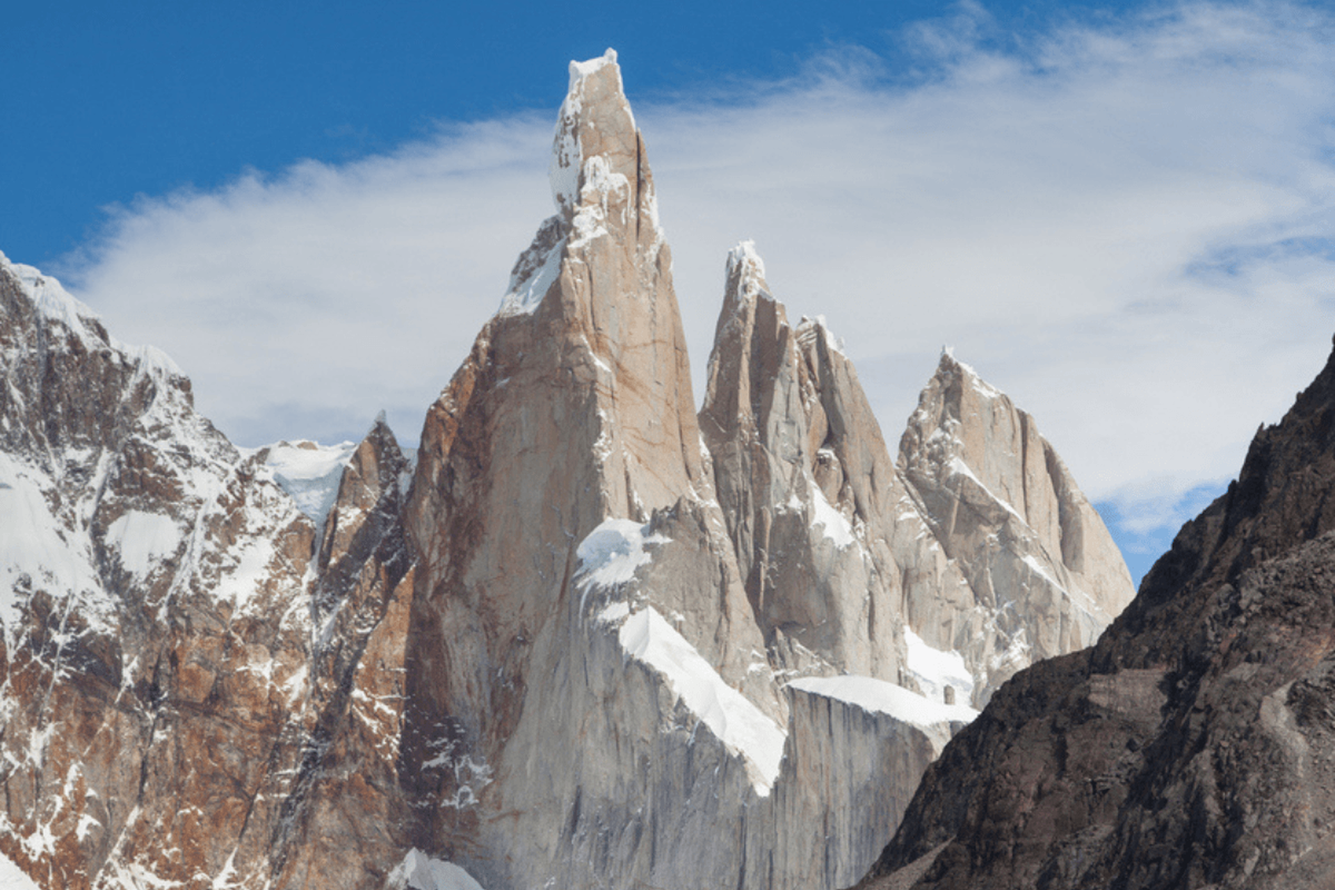
Cerro Torre is an iconic tower of a mountain, famous for its difficult ascent.
But what’s the best way to actually trek and view this iconic peak?
In our opinion, the best way to soak up the drama of Cerro Torre is to view the peak while trekking the Laguna Torre trail. Why? Because it means avoiding the technical summit while gaining breathtaking views of nearby glaciers and lakes.
Here’s everything you need to know about Cerro Torre and the trail, including where to start, what to expect, and when to book your trip.
What is Cerro Torre?
Cerro Torre is one of Patagonia’s most iconic mountains, famous for its dramatic granite spire, extreme climbing conditions, and notoriously difficult summit.
Here’s the lowdown on the iconic peak.
Where is Cerro Torre?
Cerro Torre (sometimes written as Cerro Tore), straddles the Argentina-Chile border, in the northern sector of Los Glaciares National Park.
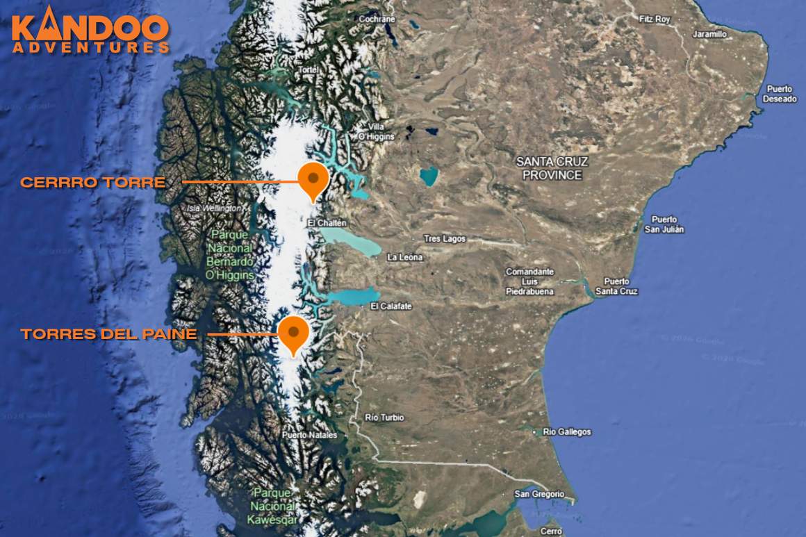
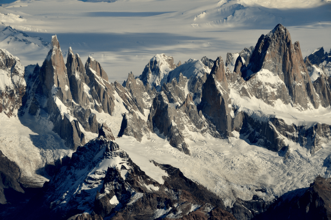
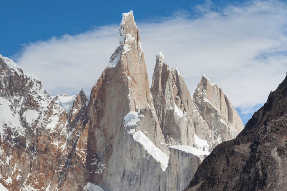
The peak is part of a four-mountain chain, with Cerro Torre standing tallest. The other three mountains are:
- Torre Egger, 2,685m, which sits directly beside Cerro Torre. A narrow saddle (known as the Col of Conquest) separates the mountains.
- Cerro Standhardt, 2,730m, the northernmost moutanin in the chain. The peak sits directly on the Argentina-Chile border, between two national parks: Bernardo O'Higgins and Los Glaciares.
- Punta Herron, 2,750m, the link between Torre Egger and Standhardt. Many people see it as a secondary summit of Torre Egger.
Other notable mentions in the area include:
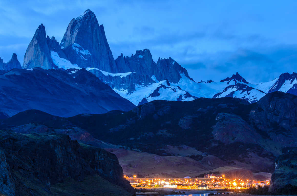
- Mount Fitz Roy, 3,405m, the neighbouring mountain that bests Cerro Torre in terms of its height. It sits 4.6km to the west of Cerro Torre.
- Cerro Grande Patagonia, 2,751m, located 8km south of Fitz Roy and sits directly beside Laguna Torre. This means it’s one of the granite walls that frame your view of the water.
We also can’t talk about Cerro Torre’s location without mentioning the ice field beneath these peaks! The Southern Patagonian Ice Field spans 13,000 square km, making it the largest temperate ice mass in the Southern Hemisphere.
The ice field is what makes this area feel so vast. It also feeds the glaciers, and is responsible for the notoriously unpredictable weather in the region.
How tall is Cerro Torres?
The Cerro Torres summit is 3,128m high, which is relatively low in comparison with some of the highest peaks in South America.
What makes it remarkable is its topographic prominence at 1,252m. 40% of Cerro Torre is free-standing rock, with no ridges or foothills connecting it to any other mountains.
This explains the peak’s iconic near-vertical shape, seemingly shooting straight out of the ice field. It makes the mountain a beauty to behold since it dominates viewpoints for miles.
Side note: Topographic prominence measures how much a peak stands on its own, rather than just the height above sea level.
How hard is Cerro Torre to climb?
Cerro Torre is one of the hardest mountains in the world to climb, with only 10-20 climbers summiting per year.
The unique ice “mushroom” at the summit is one of the reasons so few climbers make it to the top. The last moments of the trek are the most technical, so you need ice climbing and mountaineering skills to finish.
And if that isn’t enough, the expedition often delivers tough conditions. Even in the summer months, you might encounter 100-200km/h winds, making the mountain unclimbable.
It’s also not uncommon for bright sunny days to turn fast, thanks to the storms that roll in off the Southern Ocean and the ice cap. A lot of climbers spend weeks waiting for a good weather window.
A brief history: The Cerro Torre controversy
1959
The first claimed ascent was by Maestri and Egger in 1959. However, Egger died in an avalanche during the descent, and the camera was never found. With no trace of their route, it was assumed that they climbed the neighbouring peak, later named Torre Egger.
1970
Maestri’s second attempt was just as controversial. Using a power drill and a semi-permanent ladder, he ascended the peak up the Southeast Ridge, stopping 30 metres short of the summit.This route actually became the standard way up for the next 40 years. But as Maestri didn’t actually summit the ice rime mushroom, his second attempt technically didn’t count.
1974
An Italian team, led by Casimiro Ferrari, made the first undisputed ascent 15 years after the original claim. The team reached the true summit, giving the peak its first universally recognised route.
What’s the best way to view Cerro Torre? The Trek to Laguna Torre
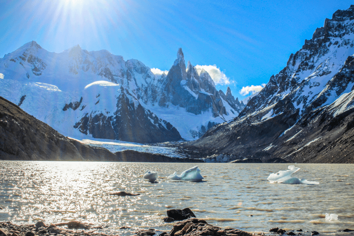
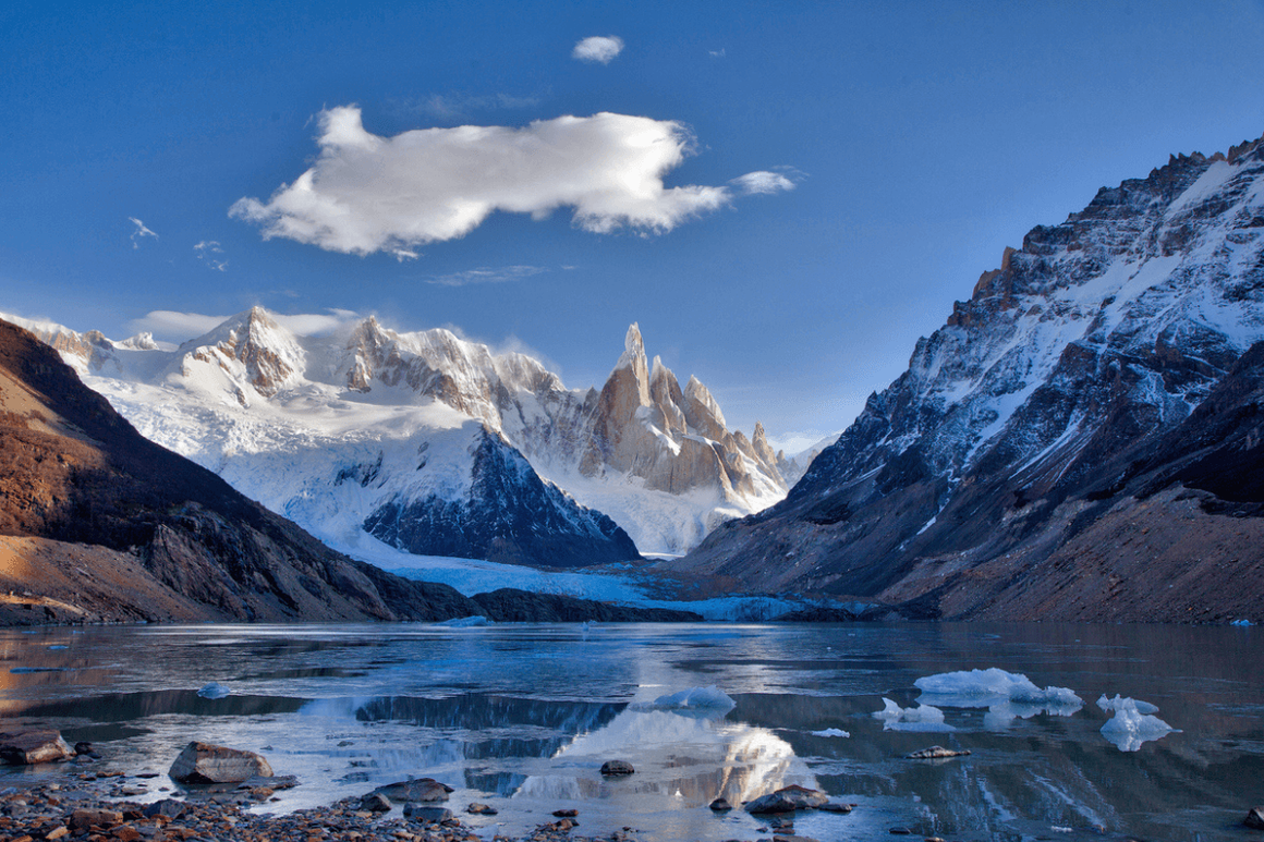
Trekking the stunning Sendero a la Laguna Torre (the Laguna Torre trail) means you can see the dramatic skyline of Cerro Torre without having to climb the tricky summit. Plus, you can see the beauty of Laguna Torre, including floating icebergs carved from the glaciers!
Here’s a bit more intel about the Laguna Torre trek:
How hard is the Sendero a la Laguna Torre Trail?
The Laguna Torre trail is more long than it is hard. That said, you gain breathtaking views of the granite tower among beautiful glaciers and lakes.
The Laguna Torre Trail: Key Facts
- Distance: 18km round trip, 9km one way
- Time: 6-8 hours
- Elevation: 535m
Optional extension: The Mirador Maestri extension brings the trip to 22km total. We recommend setting aside a full 8 hours for this.
Where does the Laguna Torre trail start?
The starting points are in El Chaltén, one of Santa Cruz’s most visited destinations.
There are two trailheads on the western edge of El Chaltén.
- North, located at the end of Calle Los Charitos
- South, located near the entrance to the ‘Cascada Margarita’ path
The best place to start depends on where you’re staying, although both trailheads merge into a single path.
Parking is available near both trailheads, but the car parks fill up quickly during peak season. It’s generally easier to walk from your accommodation if you’re staying nearby.
Recommended reading: If you have extra time in the town, check out our guide detailing the best things to do in El Chaltén.
What to expect on the Laguna Torre trail
The first 3km of the trail has most of the elevation gain, meaning you get the hard work out of the way early. After that, you enjoy a gentle stroll through glacial moraines.
Wind will be your biggest adversary, and the temperature can drop dramatically once you’ve left town. During peak season (December to February), temperatures range from 7-18°C.
We always recommend checking the wind forecast the night before. Anything over 50-60km/h makes a case for sticking to the main trail, rather than pushing on to the Maestri extension.
Prepare yourself for an immediate payoff. The Cerro Torre reveals itself instantly the moment you clear the treeline, making this one of the most rewarding ways to take it in.
Top tip: Keep your eyes peeled for Andean condors, which you can spot along this route! You also might see guanacos grazing in the field sections.
What are the best viewpoints on the Laguna Torre trek?
The best viewpoints include Cascada Margarita, Mirador del Torre, Laguna Torre, and Mirador Maestri.
Here’s a bit more about each viewpoint:
- The Cascada Margarita viewpoint. You’ll reach this within the first 1.5km. Enjoy views of the Margarita waterfall and catch a glimpse of Mount Fitz Roy to the north.
- Mirador del Torre. 2.5km in, you get your first proper peek at Cerro Torre. Many hikers turn around here after marvelling at the sight, but we think the best views are yet to come!
- Laguna Torre. The final kilometre involves a short scramble before you see the lake. You also get to see Cerro Torre rising behind the lake, and beside it you can see Cerro Grande Patagonia.
- Mirador Maestri. If you’ve anything left in the tank, the Mirador Maestri gives you up-close views of Laguna Torre and Cerro Torre. However, you need to travel a further 2km (each way) across an extremely exposed ridge, with a steep drop on one side.
When to visit Cerro Torre
The best time to visit Cerro Torre is between December and February, which has the longest daylight hours and more stable weather.
Here’s how the seasons shape up for Patagonia trekking in Argentina:
- Summer (December - February). Summer is the peak summer season, so expect the warmest temperatures and longest days. That said, it’s also the busiest (and sometimes windiest!) time to visit.
- Spring (October - November) and Autumn (March - April). The transitional seasons offer fewer tourists and beautiful colours. The weather is more unpredictable though, and some trails, campsites, and facilities may be closed.
- Winter (May - September). Snow and ice make the place look wonderfully pretty, and you’ll encounter fewer crowds. That said, ferries and buses can be limited, making it harder to get around.
Trekking near Cerro Torre with Kandoo
Sendero a la Laguna Torre is a spectacular adventure, but if you’re attempting it independently, there’s a lot to plan and figure out.
One of the best ways to experience Cerro Torre is to join Kandoo’s Peaks of Patagonia trek. Let us do the planning so you can enjoy the beautiful mountains and scenery. Plus, you have the benefit of an expert guide at hand to talk you through local customs and keep you safe.
Here’s what you need to know about heading to Cerro Torre with Kandoo.
Peaks of Patagonia itinerary
Why settle for a fleeting glimpse of Patagonia’s iconic peaks when you could spend 15 days among them?! Our trip sets aside four dedicated days for exploring Cerro Torre and Fitz Roy, before going on to the famous Torres del Paine W Trek.
Here are a few trip highlights:
- Visit the Maestri Viewpoint (weather permitting) for unparalleled views of Cerro Torre and Laguna Torre.
- Summit Loma de las Pizarras to experience spectacular Fitz Roy views.
- See Perito Moreno Glacier, which has been described as “the most striking sight in the park”.
- Reach lesser known but equally stunning glacial lagoons like Laguna Sucia and Laguna Capri.
- Hike the W Trek in Torres del Paine, including Mirador las Torres and the French Valley’s Mirador Británico.
- Camp beneath the peak to wake to unparalleled views of Cerro Torre and Fitz Roy while sipping your morning coffee. What’s included? A local guide, transfers, some camping equipment, meals, and more. Full details, including an itinerary, are available on our Peaks of Patagonia page!
Please note: This trip is for experienced hikers, with up to 8 hours of daily walking and even more planned on summit days. If you have questions about your suitability for this trip, send us a quick message and we can talk you through the options.
Plan your Cerro Torre trip with Kandoo Adventures
Cerro Torre and the surrounding peaks are definitely worth a visit if you’re planning a trekking expedition in Patagonia. While a day trip along Sendero a la Laguna Torre might suffice, there’s no better experience than camping at the foot of the mountain.
Ready to book your trip? The Peaks of Patagonia is a 15-day excursion, with four dedicated days for trekking and camping beneath Cerro Torre and Fitz Roy. It’s the perfect option if you’re looking to embark on an epic journey you’ll never forget!